The History of the Barbados Lighthouses
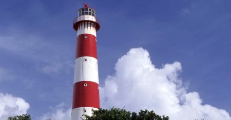

A lighthouse is never just a pretty landmark on a postcard. On Barbados, these solitary towers stand at the hard edges of the island – places where coral reefs, Atlantic swells, and shipping lanes have always demanded respect. The history of the Barbados lighthouses is a story of trade, empire, danger at sea, and the practical ingenuity required to guide sailors toward a small island with a very big role in Caribbean history.
For travelers who want to see beyond the beach, the island’s lighthouses offer a fine excuse to follow the coast, listen to the wind, and read Barbados from its headlands inward. They are reminders that this island has long been connected to the wider world – by sugar, rum, migration, naval power, and the sea.
Why Barbados Needed Lighthouses
Barbados rises abruptly from deep Atlantic water, but its coastline is not an easy welcome for ships. Reefs, shallow shelves, strong currents, and crashing surf have challenged mariners for centuries. Before reliable navigational aids, approaching after dark or in rough weather could be a serious gamble.
That mattered enormously in the colonial era. Barbados was one of Britain’s most valuable Caribbean colonies, built on a brutal plantation economy that shipped sugar and molasses outward while bringing goods, people, and news into Bridgetown. Merchant vessels, naval ships, fishing boats, and inter-island craft all depended on safer passage around the coast.
Lighthouses did not eliminate the dangers. A beacon can show a captain where land is, but it cannot calm the Atlantic or erase a reef. What it did provide was certainty: a known light, from a known position, helping vessels identify their approach and make better decisions in uncertain conditions.
The First Lights on Barbados’s Southern Coast
South Point Lighthouse and a Changing Island
South Point Lighthouse, near the island’s southern tip, is widely recognized as Barbados’s first lighthouse. Built in the mid-19th century, it came at a time when maritime navigation was becoming more organized across the British Caribbean. Its location was no accident. The southern coast faced busy routes linking Bridgetown, the eastern Caribbean, and the wider Atlantic.
The tower is modest rather than grand, and that is part of its charm. Barbados’s lighthouses were working infrastructure, not monuments designed to impress. Their job was to help vessels avoid trouble and find their bearing, night after night.
Standing near South Point, it is easy to picture a very different coastline. The area now feels connected to modern communities, airports, resorts, and busy roads, but the sea has kept its old character. It can look perfectly blue and polite one moment, then remind you why sailors valued a fixed beam of light the next.
Needham’s Point and Bridgetown’s Maritime Gateway
Needham’s Point Lighthouse served the waters near Carlisle Bay and Bridgetown, the island’s principal harbor area. Its purpose was closely tied to the capital’s commercial life. Bridgetown was where cargo was landed, markets flourished, merchants operated, and people arrived from across the Atlantic world.
The nearby harbor has changed dramatically over the years. Modern port facilities now handle cruise ships and cargo vessels with technology that 19th-century captains could scarcely imagine. Still, Needham’s Point remains a useful symbol of the older maritime city – one that relied on landmarks, local knowledge, and lights on the shore.
For cruise visitors, this connection adds another layer to a day in Bridgetown. The harbor is not simply where you step ashore. It is part of a much longer story of arrival, exchange, conflict, and resilience. A good history walk through the capital should always leave room for that bigger picture.
East Point: A Beacon Facing the Atlantic
If the south and west coasts tell the story of trade and harbor life, the east coast tells a different tale. Here, Barbados meets the open Atlantic head-on. The scenery is dramatic, with powerful surf, exposed cliffs, and winds that seem to have somewhere important to be.
East Point Lighthouse, positioned at Ragged Point near the island’s southeastern edge, was established in the late 19th century to warn and guide vessels navigating this more exposed side of Barbados. It is associated with the rugged, less commercial character of the parish of St. Philip, where open fields and sea views still give visitors a sense of the island beyond its resort corridors.
This is one of those places where the landscape explains the history without much fuss. Look out at the waves and you understand why a lighthouse belonged here. The coast is beautiful, certainly, but it has never been tame.
A visit to this side of the island works best when paired with an unhurried countryside route. The pleasure is in the contrast: cane country and quiet villages inland, then the sudden sweep of ocean at the edge of the road. It is the sort of Barbados that can be missed when a vacation is planned entirely around one beach and a hotel pool.
Harrison Point and the Northern Watch
Harrison Point Lighthouse, on the northwestern coast, is the youngest of the island’s major historic lighthouses. Built in the early 20th century, it reflects a period when navigation systems were becoming more standardized and maritime traffic still mattered deeply to the island’s economy.
Its setting near the northern tip is striking. From this area, the Caribbean Sea stretches westward while the island’s north coast curves toward more rugged terrain. The light helped mariners distinguish their position as they traveled around Barbados, especially when approaching from the north or west.
Harrison Point also shows how quickly technology can change the role of a landmark. Today’s vessels use satellite navigation, electronic charts, radar, and radio communication. The old dependence on a keeper maintaining lamps and lenses has largely disappeared. Yet the tower still has presence. It says something about the discipline of keeping watch – a quality that never goes entirely out of style at sea.
The Human Work Behind the Beacons
It is tempting to tell lighthouse history through buildings alone, but the lights only mattered because people kept them operating. Lighthouse keepers and maintenance crews had demanding, repetitive work. Lamps needed fuel, lenses needed cleaning, mechanisms needed attention, and records had to be kept. A failure on a dark or stormy night could have real consequences.
The work was often isolated, though Barbados is small enough that no point is truly far from community. Keepers lived with the rhythms of weather and the sea in a way most visitors never do. They watched ships pass, noticed changes in the wind, and understood that their routine was part of a larger system of safety.
That human element is worth remembering when you visit a lighthouse. The tower may look still, but it represents long nights, careful maintenance, and local knowledge. No glamorous movie moment required – just dependable work, properly done.
What the Lighthouses Reveal About Barbados
The history of the Barbados lighthouses also reveals the island’s geography. Barbados is the easternmost island in the Caribbean, standing apart from the volcanic chain of the Lesser Antilles. Its coral limestone base, Atlantic exposure, and position on regional sea routes made coastal navigation especially significant.
It reveals economic history too. The lights served an island shaped by maritime commerce, including the wealth generated through enslaved African labor on sugar plantations. That history cannot be separated from Barbados’s ports, shipping routes, warehouses, and coastal landmarks. A lighthouse may seem neutral, but it stood within a world of trade that carried both opportunity and immense human suffering.
And then there is the cultural side. Bajans have always had a close relationship with the sea – through fishing, commerce, sport, food, family stories, and weather-watching. The lighthouse belongs to that living coastal heritage. It is not just about ships from elsewhere. It is also about the islanders who have made their lives beside the water.
Seeing These Landmarks With Care
Lighthouses are best appreciated as part of a wider journey, not as a frantic checklist. Some sit near active roads, exposed cliffs, or working coastal areas, so visitors should respect barriers, private property, and changing sea conditions. A sunny day is no excuse to underestimate wave action on the Atlantic side. The ocean does not care how good your vacation photos look.
For a more meaningful outing, combine a lighthouse stop with the communities and landscapes around it. Notice the fishing boats, the old coral-stone structures, the changing vegetation, and the way the coast shifts from calm Caribbean waters to wild Atlantic surf. Barbados is only 21 miles long, but its personalities change quickly.
At eBike Barbados, our local guides love those moments when a coastal view opens up and the story behind it comes alive. Whether you are rolling gently along a country lane or walking through historic Bridgetown, the best island experiences leave room for the details that bus windows tend to blur.
The next time you spot a lighthouse on Barbados, pause for a minute before moving on. Look beyond the tower to the reef, the horizon, and the route a sailor once had to judge by eye. You may find that the real beacon is not the structure itself, but the island history it helps bring into view.